I located the problem in GoogleEarth - Panoramio Photos had an element dated
Full_22Jul13 which displayed sea ice... WTHO? With it removed the NWS kmz ice file is identical to the NWS Sea ICe Analysis chart.
Thanks NWS for helping to resolve this error. Suggestion - remove Panoramio Photo data elements when working with kmz ice data.
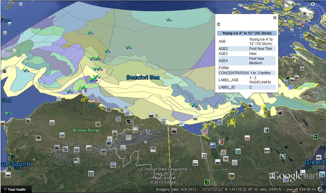
Dramatic difference between the Canadian Ice Service Alaska Coast ice chart and the National Weather Service KML ice file displayed in GoogleEarth. DO NOT RELY ON NWS kmz ICE FILES WITHOUT ANOTHER REFERENCE TO CHECK FOR ACCURACY.
http://pafc.arh.noaa.gov/data/ice/shapefiles/latestIceMap.kmz
Note - no ice pressed up to the Alaska Arctic Coast... next look at NWS kml ice data... OUCH!!!


1 comment:
Can anyone explain the big error? NWS chart says SIF (sea ice free) and kml shows many areas of sea ice in the SIF areas. BIG ERRORS!!!
Anyone HELP? How about it NWS?
Post a Comment
Enter your comment(s) here...