Friday, November 30, 2012

2013 NW Passage updates will be posted here - please comment


UPDATE from http://northwestpassage2012.blogspot.com

20121130 UPDATE - Sorry to report that there has not been enough interest to crew for a 2013 NW Passage so we are departing south to Florida, Mexico, Panama Canal then back north to Mexico, California to home port in Oregon USA.

Alaska in 2013 and beyond...

I'll continue to monitor the boats attempting a 2013 Northwest Passage and provide updates on blog site: 

http://northwestpassage2013.blogspot.com/ 

I suggest you bookmark this url.

I'd appreciate checkins with your boat, crew and contact particulars. So many times it would be nice to know who is ahead or to receive condition reports. If you post your information on the 2013 blog everyone has a community sourced location to reference.

I strongly suggest you consider using a www.findmespot.com GPS beacon to provide real time position tracking. Friends and family with thank you!

See you on northwestpassage2013 when new Arctic information becomes available.

Smooth seas to all,

Doug
Friday, November 2, 2012

Final call for crew for a 2013 Northwest Passage - Deadline: November 15th, 2012

Who would like to go on a 2013 Arctic Northwest Passage during a 10,000 nautical-mile voyage to home port aboard M/V GREY GOOSE?

A crewing deadline of November 15th 2012 has been set - email me if you are interested in more information.

Departure would be May 2013 from Mobile Alabama.

About 30 ports of call along the route.
Arrival in Astoria Oregon October 2013.


Can't do the whole voyage?  Consider port-to-port legs of the voyage to suit your interest and schedule.

Crew berths are limited - don't wait any longer to sign on.

Email: mvgreygoose (at) clear.net

More details are available online at: http://www.greygooseadventures.com/nwp/index.html


Friday, October 5, 2012

Northwest Passage in 2013? Please comment here for important fleet NWP updates and database.

Anyone planning a 2013 Northwest Passage - please comment below with your vessel name, flag, length, captain's name, number of persons onboard and satcom contact number.

When boats from the east or west are underway - there are circumstances which other boats can benefit from - I hope to help all NWP boats with a unified place they can look to find informations.  HERE!

Thanks,

Doug
mvgreygoose (at) clear dot net

What is the best place to start if thinking about a 2013 NW Passage?

I’d suggest you download and read the RCC Pilotage Foundation “Arctic & Northern Waters” 2011 version by Editor Jane Russell: 

Tuesday, October 2, 2012

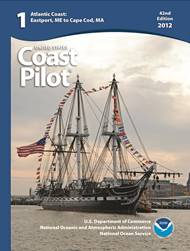
New Edition of Seminal US Coast Pilot

File Image credit NOAA

The United States Coast Pilot, with one of the Nation’s longest publishing records, like fine wine, improves with age.

The United States Coast Pilot®, originally called the American Coast Pilot, has been published for over 200 years. This set of sailing directions for U.S. coastal waters has kept millions of mariners safe from perils at sea. Recently, NOAA’s Office of Coast Survey unveiled yet another improvement to the nine-volume set geared to modern mariners who need updated information as soon as it becomes available.

Anyone can now access PDF versions of the United States Coast Pilot that are updated weekly. The volumes, and the list of corrections or updates applied each week, are available for free on the NOAA Coast Survey website.

The U.S. Coast Survey, an early predecessor to NOAA, had the knowledge, the capacity, and, one could argue, a responsibility to ensure the timeliness and accuracy of sailing directions for U.S. coastal waters. The agency published its version of sailing directions in George Davidson’s Directory for the Pacific Coast of the United States.

Today, United States Coast Pilot users can be their own printers if they wish, and they have an easier way to keep track of changes. The “Weekly Record of Updates” (now preceding the index) provides a quick reference and cumulative listing of all affected paragraphs revised at the time of download.


Don't forget to update Sailing Directions with online downloads at:

http://msi.nga.mil/NGAPortal/MSI.portal?_nfpb=true&_pageLabel=msi_portal_page_62&pubCode=0010


Sailing Directions (Enroute) include detailed coastal and port approach information, supplementing the largest scale chart of the area. Each publication is subdivided into geographic regions, called sectors, which contain information about the coastal weather, currents, ice, dangers, features and ports, as well as a graphic key to the charts available for the area.

Likewise, I recommend you download Pilot Charts and learn the principal characteristics for a particular area - here is the link:

http://msi.nga.mil/NGAPortal/MSI.portal?_nfpb=true&_pageLabel=msi_portal_page_62&pubCode=0003


Pilot Charts depict averages in prevailing winds and currents, air and sea temperatures, wave heights, ice limits, visibility, barometric pressure, and weather conditions at different times of the year. The information used to compile these averages was obtained from oceanographic and meteorologic observations over many decades during the late 18th and 19th centuries.

The Atlas of Pilot Charts set is comprised of five volumes, each covering a specific geographic region. Each volume is an atlas of twelve pilot charts, each depicting the observed conditions for a particular month of any given year.

The charts are intended to aid the navigator in selecting the fastest and safest routes with regards to the expected weather and ocean conditions. The charts are not intended to be used for navigation.


And don't forget the USCG Light List download at:

http://msi.nga.mil/NGAPortal/MSI.portal?_nfpb=true&_pageLabel=msi_portal_page_62&pubCode=0014

The USCG Light List is published in seven volumes and contains lights and other aids to navigation used for general navigation that are maintained by or under the authority of the U.S. Coast Guard and located in the waters surrounding the United States and its Territories.

Each volume corresponds to a different regional area and contains more complete information on each aid to navigation than can be conveniently shown on charts. This publication and the data contained within it is maintained and published by the USCG.

The USCG Light List publications can be downloaded in their entirety as PDF files. The aids to navigation data contained within the publications are also available for query and download from our on-line database using the form below.

Wednesday, August 29, 2012

WORLD RECORD DATED 20120829 - CAPTAIN DAVID COWPER IN M/V POLAR BOUND is the first to navigate the original Northwest Passage since discovery in 1851


File:Cowper stromness.jpg
Date: 20120829 1200hrs - Position 74 21 62N -124 57 36W

(GBR) Captain David Scott Cowper, age 70, aboard M/V POLAR BOUND has become the first in history to successfully navigate solo through McClure Strait over the top of Banks Island on the original Northwest Passage route discovered by Captain Robert McClure in 1851 aboard HMS INVESTIGATOR.


Captain David Scott Cowper has done what no one else in the last 161 years could - not even the 1,005 foot, 43,000hp Icebreaker SS MANHATTAN could not transit through the sea ice - she had to turn around in McClure Strait - Captain Cowper achieved his accomplishment with his specially built aluminum 48 foot M/V POLAR BOUND powered with a single 170hp Gardner 8LXB engine carrying 10 tons of diesel fuel.

Captain David Scott Cowper now becomes the only person to complete four solo Northwest Passages and is on his seventh(?) world solo circumnavigation. Might this be a Polar circumnavigation?  Time will tell...

My hat goes off to you!!! A job well done!!!


GOD SPEED POLAR BOUND AND HER GOOD CAPTAIN!


File:Cowper fortross 2004.jpg

Friday, August 10, 2012

2013 Northwest Passage Expedition - hurry for an open crew berth


The original Northwest Passage was discovered in October 1851 by Captain Robert McClure while standing on Banks Island - he could see a mountain peak on the northeast horizon - using a chronometer he was able to determine longitude by observing local apparent noon against his watch set to London GMT knowing it was zero longitude, a simple calculation knowing there are 24 hours in the earth's 360 degree rotation so 15 degrees each hour (360/24=15) or one degree every 4 minutes (60/15=4). Using celestial sightings they determined their position as 73°10′ N, 117°10′ W. 

He knew from reading Captain John Ross's second arctic voyage log from 1829 that the VICTORY was stuck in the ice four years in Prince Regent. Ross's nephew James Clark Ross found the magnetic north pole on the Boothia Peninsula during this encampment. In 1832, Ross and his crew abandoned their ship and walked to the wreck of HMS Fury off Sumerset Island which had been abandoned by William Edward Parry's 1824-1825 Arctic expedition, seven years earlier. A year went by before a break in the ice allowed them to leave, on that ship's longboats. They were eventually picked up by a British vessel, HMS Isabella (which Ross had commanded on his 1818 expedition), and taken home.

Captain McClure remembered reading that from May 1819 until December 1820 Hecla was commanded by Parry. She and her companion ship, the gun Brig Griper, reached a longitude 112°51' W before backtracking to winter off Melville Island at Winter Harbour. No ship to that date was able to travel so far west in search of a Northwest Passage. 

Captain McClure's local apparent longitude by sun observation confirmed they were within the immediate position of Melville Island and the mountain peak on the northeastern horizon across the sea strait had to be Melville Island where Captain Parry stayed in Winter Harbor. 

He had found the Northwest Passage!


On October 21st, Captain McClure crossed the frozen sea strait, later named after him as McClure Strait, and found Winter Harbor along with a cache of supplies from previous explorers. He placed a written note in a stone carin should anyone find it telling of his crew's position at Mercy Bay on Banks Island.


Click screen to close


http://www.hull.ac.uk/mhsc/FarHorizons/Frames/melville_island.htm
This is Parry's Rock, a Canadian landmark located at Winter Harbour on Melville Island. It was where William Parry and his ships, Hecla and Griper spent the winter of 1819/1820 on the first recorded voyage into the Arctic islands. The rock is engraved by his expedition. In 1909, the Canadian Joseph-Elzéar Bernier visited the rock and claimed the Arctic in the name of Canada. There is also a plaque on the side of the rock commemorating the event.

Captain McClure returned to Mercy Bay on Banks Island on October 31st.

"October 31st, the Captain returned at 8.30. A.M., and at 11.30. A.M., the remainder of the parting, having, upon the 26th instant, ascertained that the waters we are now in communicate with those of Barrow Strait, the north-eastern limit being in latitude 73°31′, N. longitude 114°39′, W. thus establishing the existence of a NORTH-WEST PASSAGE between the Atlantic and Pacific Oceans."

Halloween on October 31st will always have a new meaning for me - The first discovery of a Northwest Passage. And hopefully in 2013 the anniversary of the first boat to navigate it from Atlantic Arctic Circle to Pacific Arctic Circle.

McClure and his crew were also the first to both circumnavigate the Americas, and to transit the Northwest Passage!

Since the discovery in 1851 I have not been able to document another surface vessel who has made a "Northwest Passage" from Atlantic Arctic Circle to Pacific Arctic Circle "Over-The-Top" of Banks Island through McClure Strait.

Who would like to go and retrace the original 1851 Northwest Passage during a 2013 attempt aboard M/V GREY GOOSE?

A deadline of November 2012 has been set - email me if you are interested in more information.

Departure would be May 2013 from Mobile Alabama.
Arrival in Astoria Oregon October 2013.

Announcement on October 31, 2013 that the original 1851 Northwest Passage was navigated by the M/V GREY GOOSE and crew.

Crew berths are limited - don't wait much longer to sign on.

Email: mvgreygoose (at) clear.net


When will the ice be open around Banks Island? About a week more - August 20th - Check back.