Anyone planning a 2013 Northwest Passage - please comment below with your vessel name, flag, length, captain's name, number of persons onboard and satcom contact number.
When boats from the east or west are underway - there are circumstances which other boats can benefit from - I hope to help all NWP boats with a unified place they can look to find informations. HERE!
Thanks,
Doug
mvgreygoose (at) clear dot net
What is the best place to start if thinking about a 2013 NW Passage?
I’d suggest you download and read the RCC Pilotage Foundation “Arctic & Northern Waters” 2011 version by Editor Jane Russell:
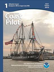
The United States Coast Pilot, with one of the Nation’s longest publishing records, like fine wine, improves with age.
The United States Coast Pilot®, originally called the American Coast Pilot, has been published for over 200 years. This set of sailing directions for U.S. coastal waters has kept millions of mariners safe from perils at sea. Recently, NOAA’s Office of Coast Survey unveiled yet another improvement to the nine-volume set geared to modern mariners who need updated information as soon as it becomes available.
Anyone can now access PDF versions of the United States Coast Pilot that are updated weekly. The volumes, and the list of corrections or updates applied each week, are available for free on the NOAA Coast Survey website.
The U.S. Coast Survey, an early predecessor to NOAA, had the knowledge, the capacity, and, one could argue, a responsibility to ensure the timeliness and accuracy of sailing directions for U.S. coastal waters. The agency published its version of sailing directions in George Davidson’s Directory for the Pacific Coast of the United States.
Today, United States Coast Pilot users can be their own printers if they wish, and they have an easier way to keep track of changes. The “Weekly Record of Updates” (now preceding the index) provides a quick reference and cumulative listing of all affected paragraphs revised at the time of download.

Don't forget to update Sailing Directions with online downloads at:
http://msi.nga.mil/NGAPortal/MSI.portal?_nfpb=true&_pageLabel=msi_portal_page_62&pubCode=0010
Sailing Directions (Enroute) include detailed coastal and port approach information, supplementing the largest scale chart of the area. Each publication is subdivided into geographic regions, called sectors, which contain information about the coastal weather, currents, ice, dangers, features and ports, as well as a graphic key to the charts available for the area.
Likewise, I recommend you download Pilot Charts and learn the principal characteristics for a particular area - here is the link:
http://msi.nga.mil/NGAPortal/MSI.portal?_nfpb=true&_pageLabel=msi_portal_page_62&pubCode=0003
Pilot Charts depict averages in prevailing winds and currents, air and sea temperatures, wave heights, ice limits, visibility, barometric pressure, and weather conditions at different times of the year. The information used to compile these averages was obtained from oceanographic and meteorologic observations over many decades during the late 18th and 19th centuries.
The Atlas of Pilot Charts set is comprised of five volumes, each covering a specific geographic region. Each volume is an atlas of twelve pilot charts, each depicting the observed conditions for a particular month of any given year.
The charts are intended to aid the navigator in selecting the fastest and safest routes with regards to the expected weather and ocean conditions. The charts are not intended to be used for navigation.

And don't forget the USCG Light List download at:
http://msi.nga.mil/NGAPortal/MSI.portal?_nfpb=true&_pageLabel=msi_portal_page_62&pubCode=0014
The USCG Light List is published in seven volumes and contains lights and other aids to navigation used for general navigation that are maintained by or under the authority of the U.S. Coast Guard and located in the waters surrounding the United States and its Territories.
Each volume corresponds to a different regional area and contains more complete information on each aid to navigation than can be conveniently shown on charts. This publication and the data contained within it is maintained and published by the USCG.
The USCG Light List publications can be downloaded in their entirety as PDF files. The aids to navigation data contained within the publications are also available for query and download from our on-line database using the form below.
